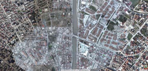
China has deployed several satellites to
capture images of the quake-hit areas in Türkiye, helping the country to
analyze the disaster situation and allocate relief resources more effectively,
according to the industry newspaper China Space News.
Using synthetic aperture radar (SAR) images
provided by China's L-SAR 01, researchers accurately portrayed the extent of
the damage caused by the earthquakes and provided important data support for
post-earthquake rescue efforts in Türkiye, said the newspaper.
China's L-SAR 01 is a satellite group
composed of two satellites equipped with L-band SAR, namely the L-SAR 01A and
the L-SAR 01B. Both satellites were
launched last year, and were tasked with providing data to support land
resource management, mapping, forestry, and disaster prevention and relief.
